
The Department has been implementing a Centrally Sponsored Scheme (CSS) ‘Integrated Watershed Management Programme’ (IWMP) since 2009-10, which was amalgamated as the Watershed Development Component of PMKSY (WDC-PMKSY) in 2015-16. The continuation of WDC-PMKSY has been allowed by Government of India on 15.12.2021 as ‘WDC-PMKSY 2.0’ for the project period of 2021-2026 with a physical target of 49.50 lakh ha and indicative Central financial outlay of Rs. 8,134 crore.
Objectives
Objectives of watershed development projects are to improve productive potential of rainfed / degraded land through integrated watershed management; to strengthen community based local institutions for promotion of livelihoods & watershed sustainability, and to improve the efficiency of watershed projects through cross learning and incentive mechanism.
Next Generation Watershed Dev – Shift in Approach
- Emphasis on effective use of rain water – relying more on water productivity.
- Transition from predominantly mechanical/engineering treatments towards more of biological measures.
- Diligent planning for crop systems diversification for risk management; enhancing productivity and opting for crop alignment as a principle.
- Diversification of the watershed economy by adopting Integrated Farming Systems (IFS) with horticulture, afforestation, fisheries, animal husbandry, apiculture, sericulture etc.
- Adaptation and mitigation of adverse impacts of climate variability & change.
- Economically vibrant institutions, like FPOs, to promote agri-business services and impart efficiency to transactions.
- Ecology, Economy and Equity.
- Focus on decentralization, flexibility, community empowerment in the planning process to accommodate local, social and traditional strengths.
- Rejuvenation of springs by taking up comprehensive treatment of springsheds as an activity under watershed development projects.
- Knowledge partnership with National level reputed institutions for capacity building and innovations.
Cost Norms
The unit cost for watershed development projects under WDC-PMKSY2.0
Rs.22,000/ha for plain areas,
Rs.28,000/ha for hilly & difficult areas (desert areas)
upto Rs. 28,000/ha for LWE/IAP Districts
Any cost over and above the cost norm to be borne by the State Governments and through convergence. States/UTs may consider effective convergence with relevant central and State schemes to ensure comprehensive development. Mapping of resources from other ongoing schemes, followed by approval of SLNA will form a way forward.
The unit cost of projects has been revised upward from Rs 12,000/ha to Rs 22,000/ha for plain areas, and Rs 15,000/ha to Rs 28,000/ha for the difficult areas and LWE areas. The States/UTs have been asked to use GIS and Remote Sensing techniques for better planning of projects. The States/UTs have also been suggested to map activities from other sectors which could be taken up within the project areas for better convergence in a saturation mode. The project period has been reduced from existing 4 – 7 years to 3 – 5 years. On the recommendations of NITI Aayog, rejuvenation of Springshed has been incorporated as a new activity in the WDC-PMKSY 2.0 within the approved cost. Till date DoLR has sanctioned projects to States/UTs covering entire physical target of land under the WDC-PMKSY 2.0 and the process of release of Central grant is under way.
End Results
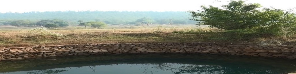
Planned works and activities successfully completed, and visible reduction in soil erosion, increase in ground water table, and enhanced green cover over both arable and non-arable lands surfaces in the project area.
The Gram Panchayat has willingly taken over operation and maintenance responsibility of assets created and transferred to them.
Community organizations namely, FPO, WDF, SHGs, User Groups etc. are operating well.
The FPO has large number of shareholding members and a healthy capital base; and has well managed Custom Hiring Centre (CHC), Input Sale Outlet, basic agri-logistic infrastructure and market facilitation for local agri-commodities.
Increases in the productivity levels of various crops and livestock
Alternate livelihood options for all members of project community – farmers, landless agricultural labours, livestock keepers, artisans etc.
The project community finds value in sustaining the treated land areas under projects and is well capacitated to manage it as a collective group.
Increase in cropping intensity, greater diversification of agricultural production system, and the total agricultural output rises substantively.
Various regulatory norms for use of water (viz water budgeting) and access to usufructs rights over assets are in place, and are adhered to by the local communities.
Increase in average income of the households in the project area.
The project communities adopt watershed project to ensure economic growth and ecological rejuvenation of the landscape.
FAQ on Watershed Development Component
Q1. How the measurement of Ground Water Table is to be done – whether data from local government department is to be taken
or actual measurement is to be done? Water table of which place in the project area is to be taken as there is wide variation within the project area?
Answer: If data is already existing with a government Department like Public Health Engineering Department, the same may be obtained. Otherwise, data may be taken from some key points within the project area. In case of data for multiple points available, an average of the same may be taken for the project.
Q2. In case of absence of unique plot number, how the plotwise data to be entered?
Answer: In such cases, based on a field survey/inquiry and information gathered from the village/community heads, the name of the person who is cultivating a specific plot of land as assigned by the village / community head may be given in plot number.
Q3. If there are more than one watersheds in a village how mapping of village and watershed committee to be done as there are more than one watershed committees?
Answer: As per para 13.2 of the Guidelines for New Generation Watershed Development Projects (WDC-PMKSY 2.0) the Watershed Committee is to be constituted at Gram Panchayat level. Members may be from all the villages covered under the particular Gram Panchayat.
Q4. How do we assign the details of the SHG which is getting benefit from different departments?
Answer: Details of Department with whom the SHG is registered are to be given.
Q5. How to give the figure of Average Annual Turnover for newly created SHG/FPO?
Answer: The initial figure of zero is to be given in such cases.
Q6. Can we edit/update the details of existing SHG/FPO during the project implementation?
Answer: Only the progress can be updated.
Q7. How verification of each work id to be done by SLNA before approval?
Answer: This needs to be ensured as per the DPR and financial progress.
Q8. How to incorporate a village in the MIS list if it is not there in LGD ?
Answer: The missing village is to be first included in the LGD with the help of concerned Department. Once, updated in LGD, same may be forwarded to DOLR-NIC for updation in MIS list.
Q9. How to accommodate a project which is covering an area lying in two different districts?
Answer: As per the existing provisions, this is not a normal case for selection of the watershed project area. However, in such cases, State may divide such project into two separate parts each lying in a separate district after taking all requisite approvals such as State HLSC and DOLR Steering Committee.

Leave a comment